April 28, 2026 - 10:00am
Type
Press Releases
(Tiny, Ontario) Municipal 511 is now live for the Township of Tiny, enhancing traffic disruption notifications for residents and visitors. This tool will be used to help communicate about road closures, lane closures, and other traffic disruptions such as construction and events.
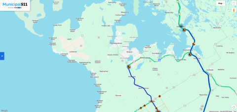
Municipal 511 is an interactive mapping system that helps to centralize planning and communication of traffic disruptions. The software will allow staff to input both scheduled and emergency traffic disruptions, making it easy for motorists to find road information.
Municipal 511 incorporates road closure information from Ontario 511, available Ministry of Transportation Ontario (MTO) cameras, and live traffic data. The program also connects with other mapping services such as Google Maps and Waze that are commonly used by drivers.
The Township of Tiny will use Municipal 511 as an additional tool to help residents and visitors stay informed about municipal traffic impacts in the township.
“We are looking forward to using Municipal 511 in Tiny as an additional resource for our community and visitors to be informed about road closure information,” said Mayor David Evans. “One of the strongest features of this software is that it connects to map applications like Google Maps and Waze so people can receive updates while driving and they will be detoured around closures.”
Municipal 511 will improve communication and public safety regarding road closures in Tiny, particularly during inclement weather.
To learn more about Municipal 511 and see the live map for Tiny, visit www.tiny.ca/roads.
-30-